Gravel Ride of the Week: Almost Heaven, (Almost) West Virginia
Disclaimer: This post contains affiliate links, through which we earn a commission.
It’s time to dig into another Gravel Ride of the Week. This week’s ride is all about exploration and seeking out some interesting gravel roads along some unexplored territories. Not all exploration rides however turn out as planned and this week’s ride is one of those instances. Sometimes you just have to listen to your gut while out on the bike and make adjustments as you go along, especially while out riding solo in a remote area. As is the case with the strange 2020 that we’ve all had to deal with, this ride can be summarized with three words: improvise, adapt and survive! Let’s take a look at this week’s ride to see how it played out.
Ride of the Week
This week’s ride kicks off in the northern tip of Virginia, in a place called Cross Junction. The initial plan was to cover some of the gravel roads in this northern tip of VA and then venture further north-east into some West Virginia mountains. I had originally planned on heading out into a wilderness area within the West Virginia mountains called, Sleepy Creek Wildlife management area. Deep within this mountainous area lies a lake seeded between the two ridge lines of the mountains. I had spent a number of hours browsing over maps to find the most suitable way up to the top of this mountain, but even after following all of my own top tips on how to best plan out a gravel route, I still didn’t quite feel comfortable with what was awaiting in this unknown area. I decided to just suck it up and go for it none-the-less.

Besides the challenge of being out there in such a remote area all by myself, the original route would provide two further challenges: distance and elevation gain. The route, as planned, would cover around 105km (65 miles) and would include around 2300m (7500ft) of leg-aching elevation gain. This route was going to provide a challenge in one way or another.

The day started out fairly well, except for a rather strange-looking sky. It was supposed to be a perfectly cloudless day, but instead the sky was a hazy brown color. You can see this clearly in my video footage as the GoPro struggled to capture the correct exposure for most of the shots that included the sky. I later learned that the haziness was in fact caused by the smoke blowing over from the Californian wildfires, some 2500 miles (4020km) away. How bizarre is that?! It really showcases the severity of the issue.
The first part of my ride turned out a bit different to what I was expecting. Some of the roads that were indicated on maps as gravel, turned out to be paved roads instead. I also ran into an interesting scenario a few times where dogs left loose within yards darted out into the road and chased me. Being from South Africa, I’m all too familiar with angry guard dogs, but for the most part, the dogs there are usually locked up behind fences. Hyper-sensitivity and a tuned ear listening out for barking dogs quickly became the order of the day during this first part of my ride. As I ventured further into the unknown, the area became more remote and it soon dawned on me that being out there on my own wasn’t exactly the smartest thing to do. I was approaching the end of my first loop (the last split-off point on my course) and had to make the call if I was going to continue along the planned route or seek out a less remote area elsewhere. I picked the latter.
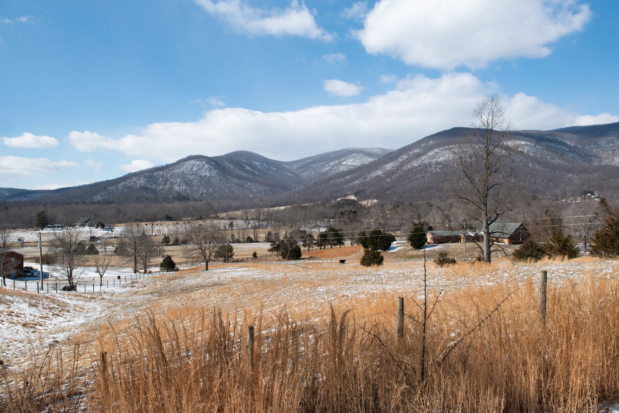
I decided not to include my out-and-back section that continued into the West Virginia mountains and the Sleepy Creek Wildlife area. Perhaps on another day, when riding with a buddy, I’ll return to this spot to finish the route. On this particular day, I opted instead to head over to the gravel loop that I had originally set out as a “bonus gravel loop.” This turned out to be a great decision and it was without a doubt the highlight of the entire ride! I got to zip past some beautiful farmland with incredible views of the mountains off in the distance. If you’re ever looking to explore some gravel at the northern-most tip of Virginia, this would be the first place I’d recommend you check out. The bonus loop (consisting of S Timber Ridge Rd and S Sleepy Creek Rd) even included a short spin along Bloomery Pike, a road that forms the border between VA and WVA, providing a view of two different states, one on each side - pretty neat!
One of the few things that I had anticipated correctly for this ride was the elevation gain. The area is certainly not flat! Even after I shortened my ride to 57km (35.5mi), the elevation gain for the day still measured in at 1200m (3900ft). I was already feeling this by the end of my ride and can only imagine that double that elevation gain would have made for one crazy ride.
Wrap-Up
At the end of the day, the ride was still great fun, and the adventure of going out into the unknown to explore a new place by bike still left me with a sense of accomplishment. It was also a valuable lesson about listening to my instinct when getting a hunch about the safety of a particular area. I will surely return to the area in the future for the WVA-portion of the ride that I missed out on. To quote John Denver, it was an “almost heaven, (almost) West Virginia” kind of ride.
Let us know in the comments below if you’ve ever shortened a ride due to safety concerns. Where were you riding?
-Wiehan