Gravel Ride of the Week: C&O Canal Towpath - Perfect for Bikepacking & Mellow Rides
Disclaimer: This post contains affiliate links, through which we earn a commission.
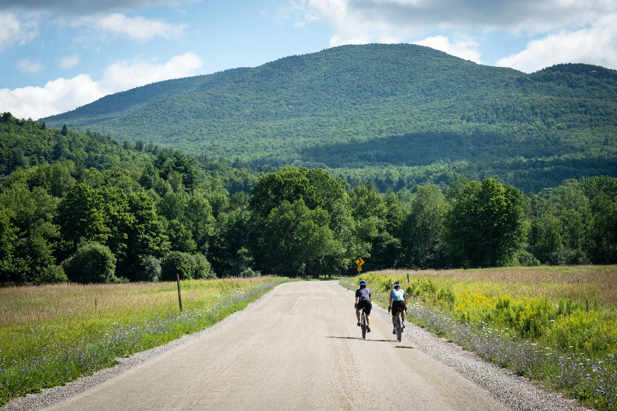
Sometimes you just need to slow down the pace and soak in the scenery. In today’s fast paced world, we can so easily fall into the trap of constantly being on the move that even a leisurely activity, such as a bike ride, can become a mad rush of chasing after a power, speed or distance goal. While productive training definitely requires a dedicated plan, it’s nice to sometimes have the goal of no goal at all. Simply ride to take it all in. That’s exactly what this week’s Gravel Ride of the Week is all about, a relaxed cruise along the C&O Canal towpath on a beautiful spring afternoon. Follow along in this post and video to see what lies along this beautiful stretch of the C&O Canal trail.
Ride Breakdown
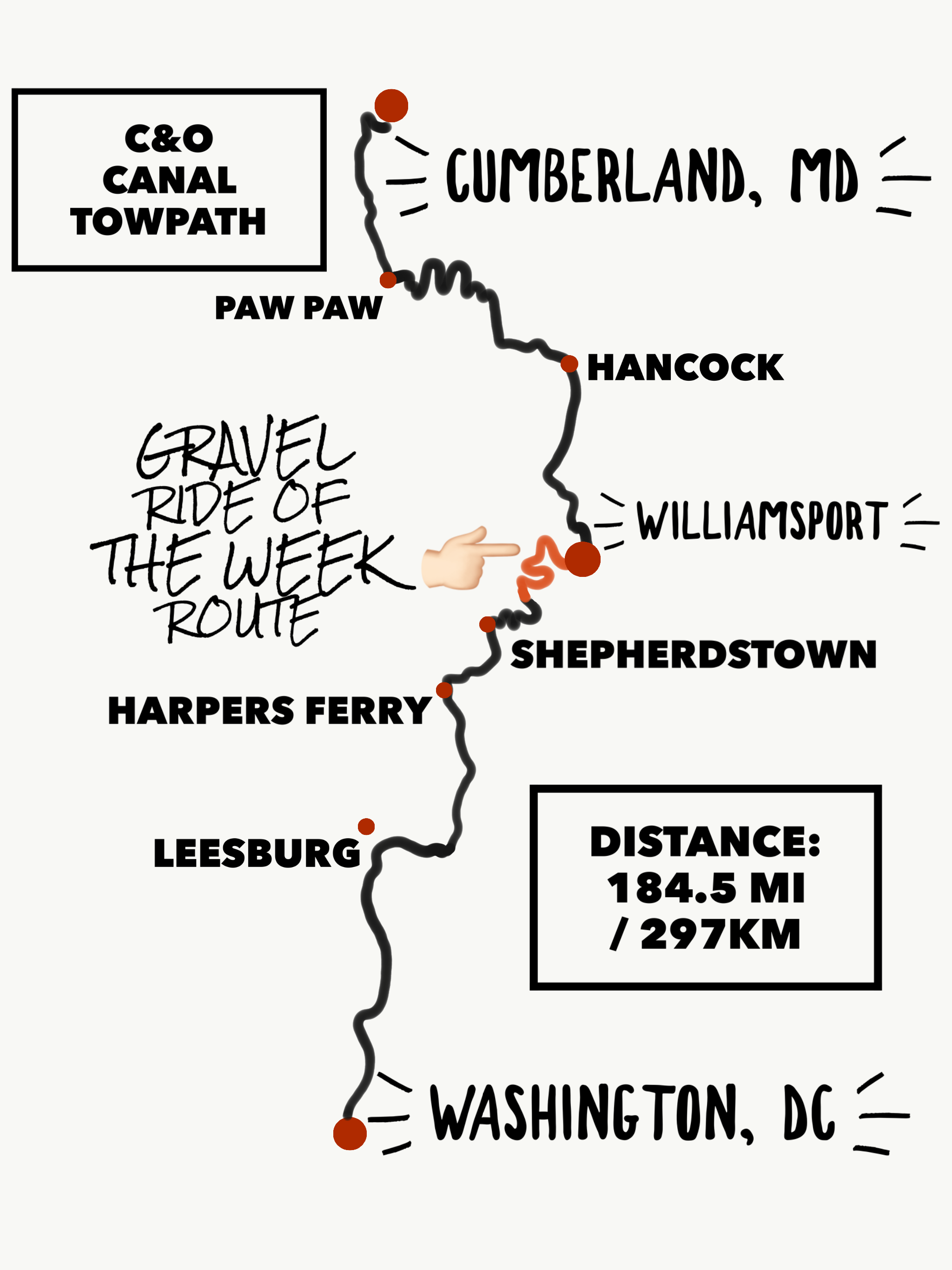
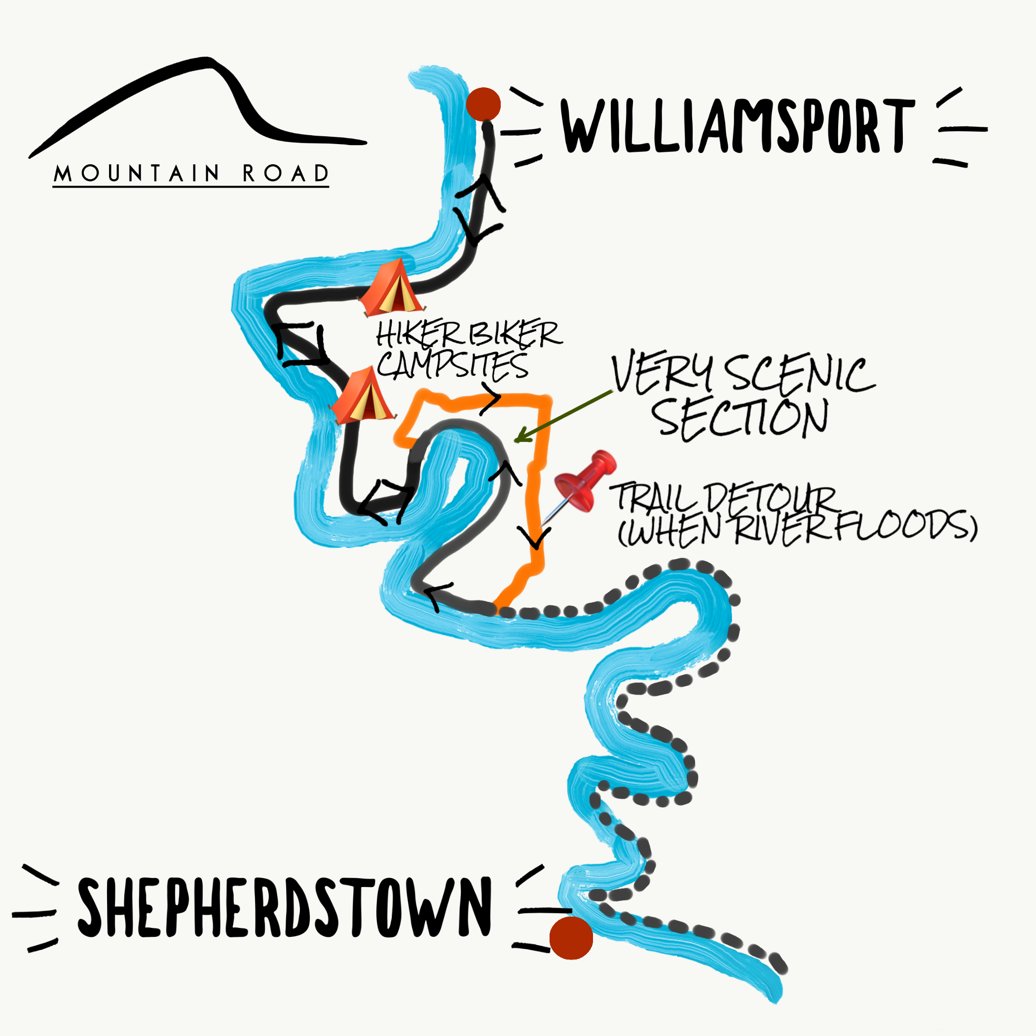
A few years ago, I had the wild idea to ride the whole Greater Allegheny Passage (GAP) and C&O Canal trail in just 4 days. This spur of the moment trip would take me all the way from Pittsburgh to Washington DC along scenic trails, a distance of 333 miles (537km). Clearly this would be no small feat, especially over such a short time frame. We documented the whole trip, but - spoiler alert - I wasn’t quite prepared for that distance of riding and had to skip over some sections of the trail. A particular section that I missed out on was the part of the C&O Canal Towpath that lies between Williamsport, MD and Shepherdstown, WV. I finally got the opportunity to travel back to this area to fill in some of the gaps from that previous trip.

For this particular ride, I decided to have the simple goal of soaking in the natural surroundings as much as possible. A mellow, relaxed Saturday afternoon cruise along the river. I had just come off of a fairly heavy week of training and the flat terrain of the C&O Canal towpath provided the perfect place to work in a nice recovery spin. Recovery days in a training plan provide the perfect opportunity to rest not only the body, but also the mind. The hardest part is sometimes just to give yourself the permission to rest. In this instance, I was also following a training method that involves a 3-week “intense” phase and a 1-week “off” phase with this ride wrapping up the reduced training-load week.

The ride followed a very straightforward route that simply went out-and-back, departing from Williamsport. There are a few points of interest worth noting along this section of the trail. The first relates to anyone interested in doing some bikepacking along the C&O Canal Towpath. In the video that accompanies this post, I give you a visual breakdown of the hiker biker campsites that you’ll find along the trail. Every few miles (usually between 5-10miles apart), you will find a small trail-side site that is perfect for camping. This site includes plenty of space for a tent, a picnic table, a fire pit (with logs if you’re lucky), a porta-potty and even a manual water pump to fill up water bottles. Take note that water from these pumps is treated with iodine and should still be run through a purification device for safety. The water is also turned off between mid-November and mid-April each year. You can find more info about the hiker biker campsites here.
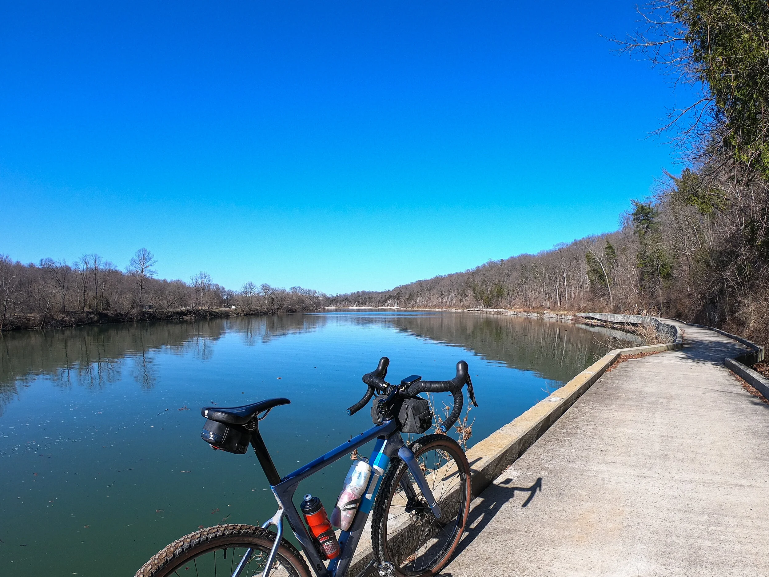
The second noteworthy part of the route was the detour that I encountered about 10.5miles (17km) away from Williamsport. There was a clearly marked boom across the trail that indicated that a trail detour was to be followed. I proceeded to follow the signs, and this took me along a 6.2mile (10km) detour that included (fairly quiet) country roads throughout the Maryland farmlands. After joining back up with the trail on the other side of the detour (close to Mercersville), I decided to head back in the direction that I came from to inspect the cause of the trail closure. What I discovered was that I could easily travel the 5-mile (8km) stretch of trail all the way back to the original detour sign without any blockage along my path. Not only was this section completely rideable, but it was also, by far, the most scenic section of the whole ride. The trail runs right on the river’s edge, so close in fact that they had to construct a concrete pathway to ensure that the trail can run through this terrain. It was then that it struck me - The trail detour is only in effect whenever the river floods, as this would cause the trail to be completely covered by water. You certainly don’t want to miss out on this truly amazing section of the trail, so be sure to observe the river conditions, should you ever get to cycle this part of the C&O. If the river isn’t flooding, then you’ll most likely be able to pass through this section without any issues.

Wrap-up
The best part about a relaxed bike ride is that you get back to your starting point feeling refreshed, rather than drained - energized by the beautiful scenery that you could truly admire and absorb along the way. In the end, my ride (including the detour) ended up being around 32 miles. This stat didn’t mean all that much since the enjoyment of simply doing what I love provided all the satisfaction that I needed from this ride. I can highly recommend that the next time you’re in need of some recharging, pick a flat or easy route, stick the body into autopilot, switch off any unnecessary thinking and simply enjoy the ride!